Cambridgeshire-Northamptonshire-Rutland-Lincolnshire
 |
OS TF019057; Multimap aerial
Where the railway line passes under the A1, a mile southwest of Stamford.
Quadpoint?
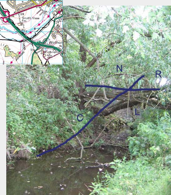
What is generally believed to be the only point in the country where four counties meet is comparatively tricky to get to, but there are many public footpaths leading there. Options to get to the field alongside the A1 are to park up in Stamford and walk the 'Jurassic Way' west along the River Welland, or to park in Tinwell and walk east along the river. Access from the A43 is not possible. Once in the field, the point is in a remote corner just before where a stream that runs alongside the railway passes underneath the big A1 carriageway. Once there it's not at all obvious where the point is, unless someone has better maps than I do. Thus picture above shows the stream, around 20 metres to the east of the A1 bridge, looking towards the bridge. The blue lines are thus a little fanciful as there is some confusion over where the point actually is.
However, since my visit I have been prompted to look a little more closely as to exactly where the point is, and have actually come to the conclusion that there is not a quadpoint after all, but two tripoints separated by about 20 metres. Here is my evidence.